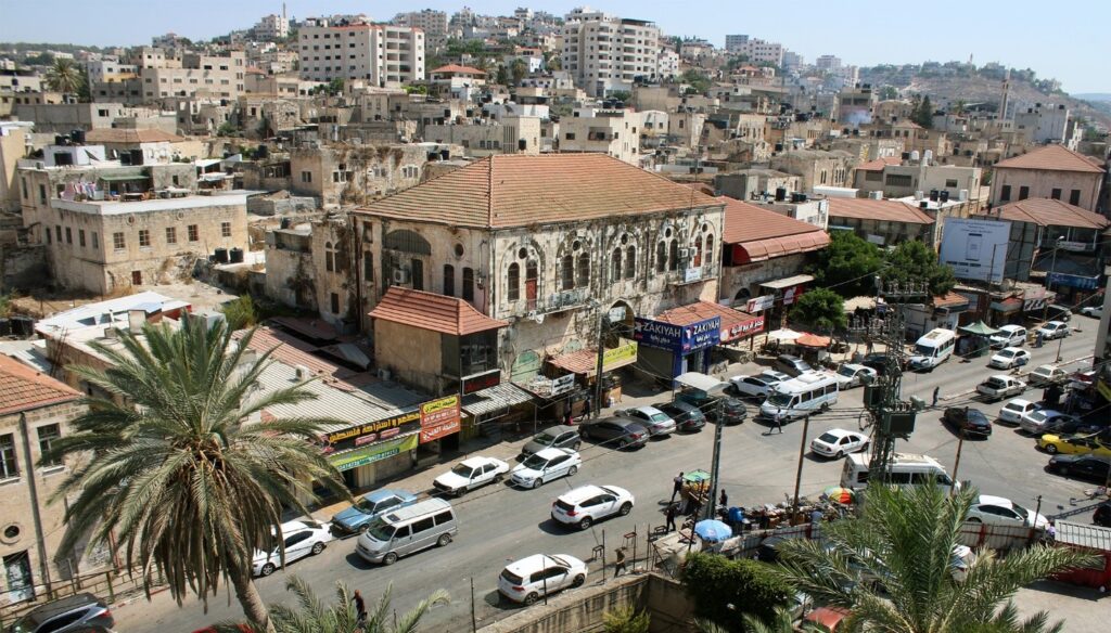
Jenin is a city in the State of Palestine, in the Israeli-occupied West Bank. The city serves as the administrative center of the Jenin Governorate of Palestine and is a major center for the surrounding towns. Starting in 1967, Jenin existed under Israeli occupation before it was put under the administration of the Palestinian National Authority as Area A of the West Bank in 1993.
Population and Refugee Camp
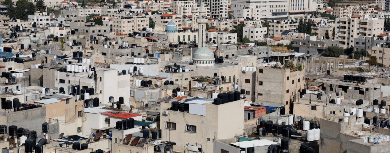
In 2017, Jenin had a population of approximately 50,000 people, while the Jenin refugee camp housed around 10,000 residents. The camp is home to Palestinians who fled or were expelled from their homes during the 1948 Palestine War, and over time, it has become a stronghold of Palestinian militants and has been the site of numerous incidents related to the Israeli–Palestinian conflict.
Geographical and Historical Significance
Jenin is located about 43 kilometers north of Nablus on the ancient trade route from Nablus through Wadi Bal’ama, across the plain of Marj Ibn Amer, and Lajjun to Haifa and sits at an altitude of approximately 100 to 250 meters above sea level. Its name, derived from “Ein Ganim,” means “the spring of Ganim,” referring to the area’s abundant springs. Historically, Jenin was known as “Gina” in the Amarna letters of the fourteenth century BC and during the Roman period, and in the Crusader period, it was referred to as Grand Grin.
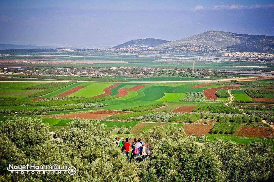
Today, Jenin is a picturesque town nestling on the slopes of a hill, with gardens filled with carob, fig, and palm trees surrounding it. The town is famous for its thriving agriculture, producing an abundance of fruits and vegetables.

Exploring Jenin: Key Sites to Visit
Explore the vibrant mix of Jenin’s cultural and historical heritage through its must-see sights, each offering a glimpse into the city’s rich past and diverse present. From ancient archaeological marvels to sacred religious sites and natural wonders, Jenin beckons visitors on an immersive journey through time and tradition.
Burqin: The Church of the Ten Lepers
The village of Burqin is situated about five kilometers west of Jenin, at the northern end of the Arraba plain, and is referenced in several historical documents. In the sixteenth century, Burqin was described as a small village, and archaeological surveys in Burqin have uncovered evidence of settlements from various periods, including the Early Bronze Age, Middle Bronze Age, Late Bronze Age, Iron Age, and the Roman, Byzantine, Umayyad, Ayyubid, Mamluk, and early Ottoman periods.
Saint George Church is located on the northern slope of Burqin’s historic center, overlooking Wadi Burqin, and belongs to the Greek Orthodox community. The church is dedicated to Saint George (Al-Khader), a revered figure for both Christians and Muslims.
The first systematic survey of the church was conducted by the Palestinian Department of Antiquities in 1997. According to this survey, there are four main architectural phases in the church’s history. Initially, the church was a cave that originally served as a Roman cistern, with the cave and the church being identified as remnants of the Byzantine period. During the second phase, a church was constructed in front of the cave between the sixth and ninth centuries, as described in documents from the Crusader and Ottoman periods. The current church, rebuilt in the eighteenth century, comprises the cave, the main hall, and the nave.
The Church of Saint George in Burqin is associated with the New Testament tradition of the ten lepers. According to Christian tradition (Luke 17:11–19), Christ entered the village on his way to Galilee and miraculously healed ten lepers who sought his help. Consequently, the church is locally known as the Church of the Ten Lepers.
Tell Taannek
Tell Taannek is a pear-shaped mound covering approximately 14 acres located at the northern end of the Nablus ridge and the southern edge of Marj Ibn Amer, about 8 kilometers south of Tell al-Mutesellim (Megiddo). The site occupies a strategic position on the border between the mountainous region and the plains along the main route between Jenin and Haifa. It lies west of the historic pass, Wadi Hasan, and east of Al-Yamoun.
The modern Palestinian village of Taannek, situated on the southeastern slope of the tell, retains the ancient name Taannach, which was mentioned around 1350 BC in the Amarna letters. Taannek was recorded as a captured city during Thutmose III’s military campaign in Asia in 1468 BC and was captured again by Shishak I in 918 BC during his campaign in Palestine. The site is mentioned multiple times in the Bible as a Canaanite town that remained undefeated by Joshua, and later, Taannek was noted as a large village in the fourth century AD by Eusebius and in Crusader records from the Middle Ages.
Zababdeh
Situated six kilometers south of Burqin, Zababdeh is built on the site of an ancient Byzantine village. At the Convent of the Rosary Sisters, visitors can find a beautiful mosaic from a sixth-century church. Additionally, the site includes a Roman structure known as Boubariya.


Khirbet Bal’ama and the water tunnel
Khirbet Bal’ama is located at the southern entrance to Jenin, about two kilometers from the city center. This site was a fortified Canaanite city strategically positioned along the historical route of Wadi Bal’ama, connecting the Arraba Plain with Marj Ibn Amer. It is identified with ancient Ibleam, mentioned in the Egyptian Royal Archive in the fifteenth century BC; during the classical period, it was known as Belmont, and in the medieval period as Castellum Beleismum.
Excavations at Khirbet Bal’ama revealed the ancient water system, demonstrating how the inhabitants of Belameh accessed the Bir as-Sinjil Spring at the base of the mound, particularly in times of war and siege. The tunnel comprises three parts: the archway at the lowest entrance, the rock-cut tunnel ascending westward, and the unfinished upper passage. The site has yielded evidence from the Bronze Age, Iron Age, and the Persian, Hellenistic, Roman, Umayyad, Crusader/Ayyubid, Mamluk, and Ottoman periods.
In 1999, the site underwent a series of restorations, and by 2005, the tunnel was rehabilitated as an archaeological park and is now open to visitors.
Tell Dothan
Tell Dothan sits on the eastern side of the fertile Arraba plain, approximately eight kilometers north of Jenin and one kilometer east of the Nablus-Jenin road, and is surrounded by fertile plains and a spring located at the southern foot of the hill. The site’s earliest traces date back to the Chalcolithic period, with significant urban development observed during the Early Bronze Age around 3000 BC. Subsequent habitation occurred during the Late Bronze Age and Iron Age I.
A notable find at Tell Dothan is a tomb carved into the western slope of the hill, containing over 1,000 intact pottery pieces and approximately 100 skeletons. The residential quarter, featuring a street, dwellings, storage spaces, ovens, and household artifacts from the Iron Age II, was also unearthed. The town experienced destruction and rebuilding phases from the ninth to the seventh centuries BC, with the Assyrians being attributed to the final destruction at the end of the eighth century BC.
While evidence of Hellenistic and Roman presence at the site is scant, it remained occupied until the Mamluk period. Local tradition associates Tell Dothan with the biblical narrative of Joseph and his brothers, particularly referencing a cistern known as Joseph’s pit.
The Forest of Umm al-Rihan
The Umm al-Rihan Forest encompasses a series of densely wooded regions spanning an estimated total area of 15,000 acres, and under the jurisdiction of the Palestinian Authority, this expanse has been earmarked as a potential location for a nature reserve. Situated within the semi-coastal region, the forest exhibits an environmental ecosystem reminiscent of the Mediterranean forest biome.
A notable feature of Umm al-Rihan is its role as a critical migration corridor for avian species traversing from the coast. Many of these birds represent threatened or dwindling populations across the Middle East, including species such as the Lesser Kestrel, Honey Buzzard, and Egyptian Vulture. Moreover, the habitat supports other endangered species such as wolves and red foxes. The woodland’s biodiversity extends to its flora, hosting original wild strains of barley and wheat alongside various wild fruit species.
Conclusion
In essence, Jenin, situated in the Israeli-occupied West Bank, holds immense significance as a central Palestinian enclave. Despite facing numerous challenges, it remains a thriving administrative center, pulsating with the energy of its approximately 50,000 inhabitants.
Moreover, the Jenin refugee camp, home to around 10,000 Palestinians displaced during the 1948 Palestine War, serves as a poignant reminder of historical upheavals. Over time, it has evolved into a symbol of resilience amidst the ongoing Israeli-Palestinian conflict.
Jenin’s geographical and historical importance, shaped by its strategic location along ancient trade routes and rich cultural heritage, adds layers to its narrative. From the bustling streets of its urban core to the tranquil orchards dotted with carob, fig, and palm trees, Jenin offers a diverse tableau of its past and present.
As visitors embark on an exploration of Jenin’s key landmarks, such as the ancient ruins of Burqin and Tell Taannek, they are invited to immerse themselves in a journey through time. Here, they can trace the footsteps of bygone civilizations while experiencing the city’s vibrant cultural tapestry.
Ultimately, Jenin stands as a testament to the enduring spirit of its people and the timeless allure of the land they proudly call home.

